Looking for Helpful Travel Apps?
One of my favorite parts of traveling is planning for the next great adventure using helpful travel apps. I usually start planning the next trip while I’m still on vacation.
There are so many useful resources out there and I wanted to share a few with you:
National Park Service App
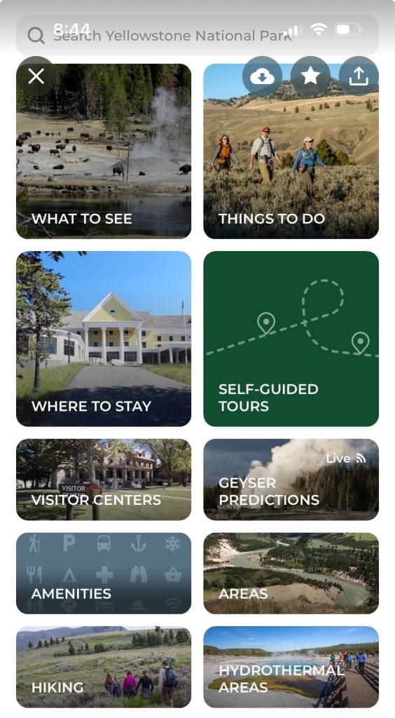
The NPS App is a great starting point for everything under the National Park Service, including:
- National Parks
- National Battlefields
- National Historic Sites
- National Memorials
- National Monuments
- National Seashores
- National Lakeshores
- National Parkways
- National Preserves
- National Recreation Areas
Under this helpful travel app, you can search by park name, category, state, and activity. Each park has information regarding what to see, things to do, visitor centers, amenities, etc. https://www.nps.gov/subjects/digital/nps-apps.htm
As you can see from the screenshot from the Yellowstone page, there is even information about geyser predictions and hydrothermal areas. This is not unique to Yellowstone, as each parkland has its own features highlighted on the app, including alerts and other news.
Parkwolf: National Park App

Seeking out the wildlife at each park is one of my primary goals, and I think Parkwolf is one of the most helpful travel apps for locating wildlife in real time using heat maps. https://parkwolf.co
The screenshot on this page shows where the bighorn sheep are in Glacier National Park at that particular moment.
The app is also helpful for planning, and includes features like:
- Trail Maps
- Park Alerts
- Audio Tour Guide
- Places to Visit
Detailed trail maps note (among other things):
- Difficulty level
- Elevation gain
- Peak altitude
- Trail length
- Estimated time it will take
Recreation.Gov App
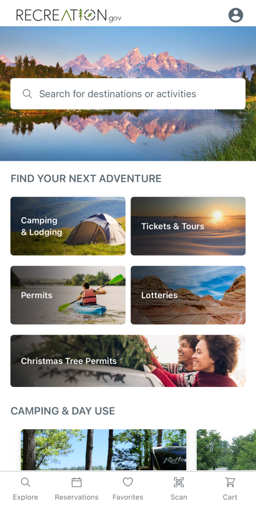
Some of the national parks require timed entry tickets on to the land, and this must be ordered at Recreation.Gov, which makes this one of the most helpful travel apps. https://www.recreation.gov/mobile-app
Parks, such as Rocky Mountain National Park, need a timed ticket to enter the park, while others need a timed ticket for a section of the park, like Cadillac Mountain in Acadia. Specific tours, for instance, exploring and walking inside Balcony House in Mesa Verde, also need tickets.
Although you can order these tickets on the website and have the tickets emailed to you, having this helpful travel app on your phone is a place to keep track of all your reservations in one place.
Most of the national parks require an entrance fee, which can be purchased on this app. If you think you will be visiting national parkland regularly, you can purchase your America the Beautiful National Parks and Federal Recreation Land Passes here as well, which are good for a year to all the national parks and areas.
Other valuable information on the app includes:
- Camping Reservations
- Backcountry Permits
- Lotteries, which provide fair access to areas like Coyote Buttes North (The Wave)
- Activity Passes, like boat stickers
- Tour Tickets, like touring Carlsbad Caverns
Rivercast App
Another helpful travel app for kayakers and canoers is the Rivercast App https://www.rivercastapp.com., which gets its data from NOAA’s National Weather Service and Advanced Hydrologic Prediction Service. You can search for water systems by the:
- Name of the waterway, e.g. Columbia River
- Official five-digit NOAA station identification, e.g. VAPW1
- Two-letter state abbreviation, e.g. OH, PA.
Waterways are measured in two ways: flow (CFS-cubic feet per second) and height (feet). Colored map symbols depict whether the waterway is at or near flood stage:
- Red = flood stage
- Yellow = near flood stage
- Green = normal conditions
- Blue = no pre-set stage defined
- Brown = low water level
- Grey = old or incomplete data/unknown data
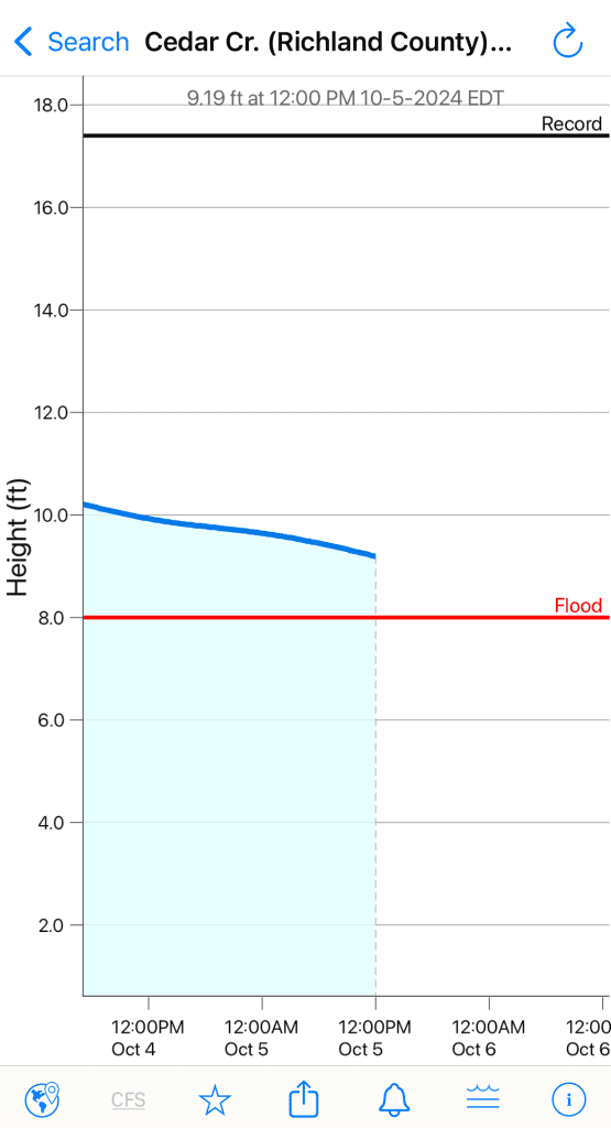
The helpful travel app shows hydrographs of current, recent and forecasts for a particular station. In the screenshot, you can see Cedar Creek in Congaree National Park was just below 10 feet, almost two feet above flood level (8 feet) Oct. 5, 2024, and that the record was over 17 feet. The app also provides weather alerts from the National Weather Service.
All Trails App
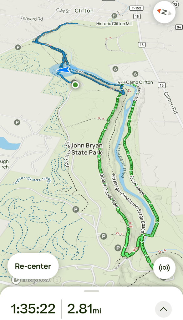
I like the All Trails App for a couple of reasons. First, it covers trails both inside and out of the national parks, such as in metro and state parks. Actually, according to the website, https://www.alltrails.com there are over 450,000 trails with maps, overview, weather conditions, estimated time, reviews, and photos.
Secondly, after you have designated your trail route (marked in green), All Trails will let you know with a blue arrow where you are on the trail. If you have veered off the trail, there will be a corresponding blue line to differentiate it from the path you originally designated. I have been known to go off my designated trail to another trail and this feature marks where I am. If I am lost, it helps me to not only get back on track but also find my car. LOL.
The app allows you to track:
- How far you have walked
- How long it takes you
- Elevation and grade at your specific location
- Type of activity, for instance, hiking, mountain biking, horseback riding, cross country skiing, etc.
