
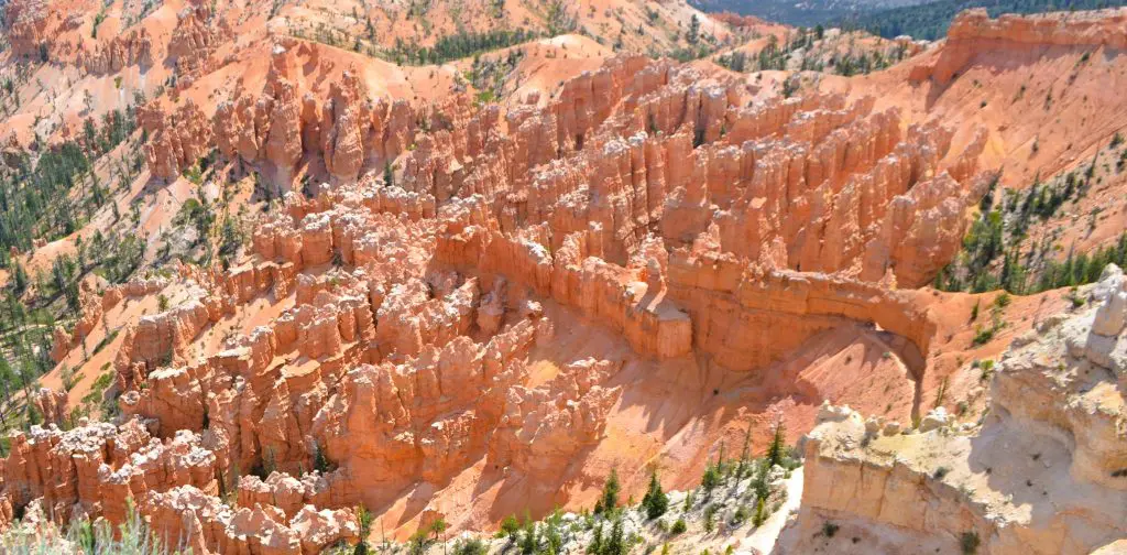
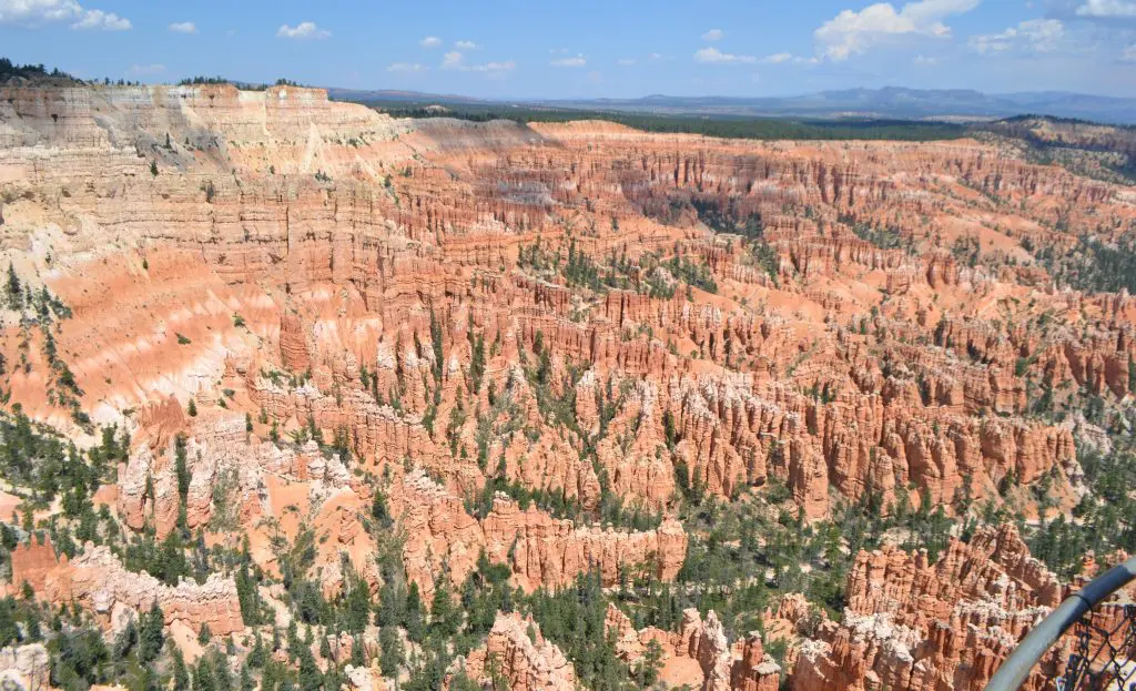
Bryce Canyon Has Largest Collection of Hoodoos
There are more hoodoos in Utah’s Bryce Canyon National Park than anywhere else in the world. Why is that?
Elevation plays a crucial part in the abundance of these tall, slender rock spires at Bryce Canyon, which is not really a canyon at all.
Bryce Canyon sits on a high plateau at the top of the Grand Staircase, which is a series of sedimentary rock extending down like steps to the Grand Canyon. Grand Staircase – Bryce Canyon National Park (U.S. National Park Service)
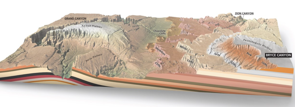
Bryce Canyon’s Pink Cliffs (shown in above diagram), on the eastern edge of the Paunsaugunt Plateau, is the highest layer of the Grand Staircase.
Creation of Hoodoos
So how were these hoodoos created over time? Bryce Canyon is at the right elevation to create so many hoodoos in one place because of three main reasons.
First, an ancient lake and floodplain from 50 million years ago stripped rock particles from highlands and deposited them in the lower basin. Hoodoos – Bryce Canyon National Park (U.S. National Park Service) These rocks, according to the website, included limestones, dolostones, mudstones, siltstones, and sandstones.
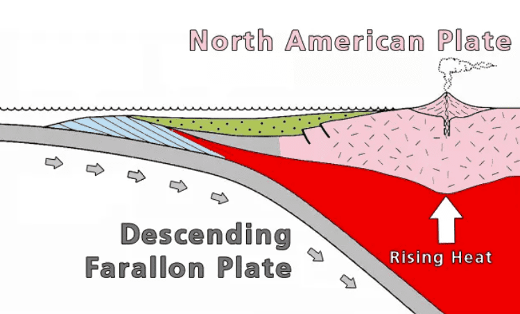
Second, in simplest terms, plate tectonic forces pushed the Farallon Plate underneath the North American Plate, raising this area. Hoodoos – Bryce Canyon National Park (U.S. National Park Service)
Finally, the elevation was perfect for weathering (the breaking down of rock) and erosion (rock transported away). The area of the park gets both above freezing and below freezing temperatures 170 nights of the year. Hoodoos – Bryce Canyon National Park (U.S. National Park Service) This is crucial for the creation of the hoodoos. The park website notes water and melted snow seeps into the rock crevices, freezes overnight which expands the rock causing it to break apart.
Highest Point of the Grand Staircase
The pink cliffs of Bryce Canyon are at the top of the Grand Staircase, which stretches upward in both direction and elevation from the Grand Canyon to Bryce and Zion national parks.
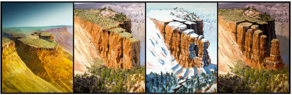
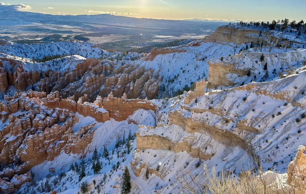
An array of reds, oranges, and yellows are visible in the narrow fins and tall hoodoos from iron oxide minerals, notes the park website. The lower half of the cliffs, called the Pink Member, has manganese oxide which brings out pinks and purples. Sunset Point (U.S. National Park Service
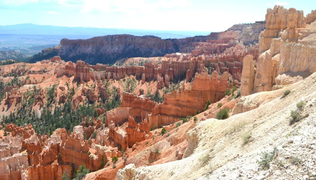
The change from orange to a light, almost white-colored rock is the beginning of the Upper Member and is a result of the absence of mineral impurities. Sunset Point (U.S. National Park Service)
Seasonal Changes at Bryce Canyon
Bryce Canyon became a national park in 1928. There are 35,835 acres, making it the smallest of the five national parks in Utah. Park History – Bryce Canyon National Park (U.S. National Park Service)
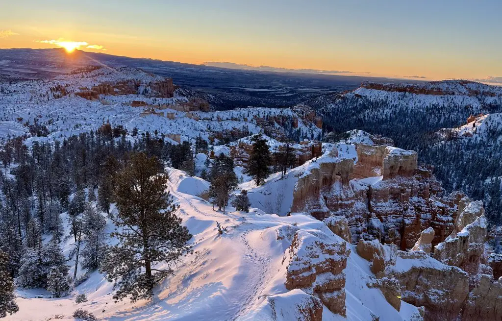
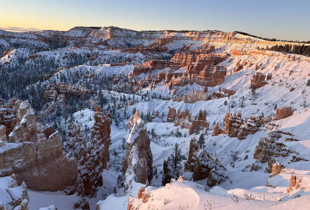
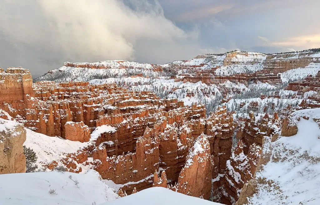
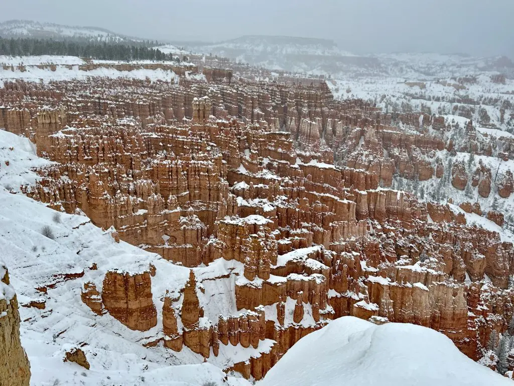
It doesn’t matter if you go in the summer or see the hoodoos covered in snow – the view is like nothing else. Each season has a completely distinctive look and vibe.
In the summer, the sandstone hoodoos remind me of drip sandcastles you see kids making at the beach. The evergreens provide a contrast against the red rock. Add snow and winter’s cloudy skies, and the color palette becomes remarkable.
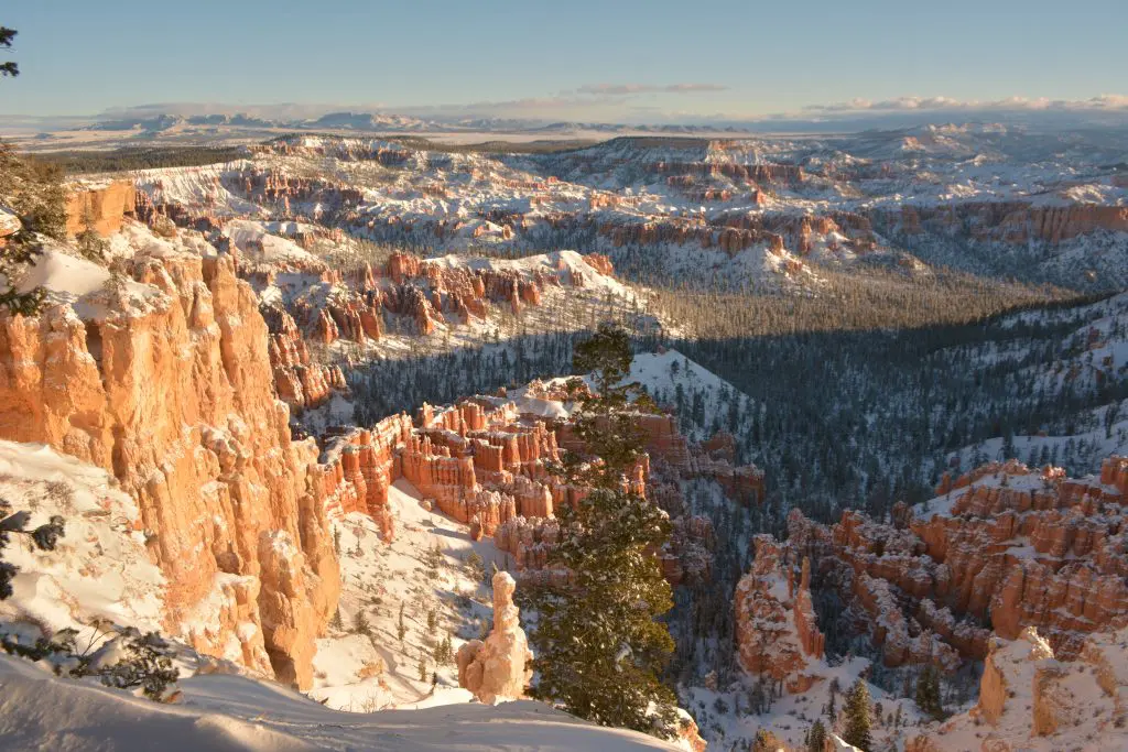
Unfortunately, with the beauty of snow comes road closures. Only four places in the Bryce Amphitheater area are open when there’s snow-covered roads.
You can still hike into other areas, if dressed properly. It was 9° Fahrenheit, and the wind chill was even colder when we were there in March.
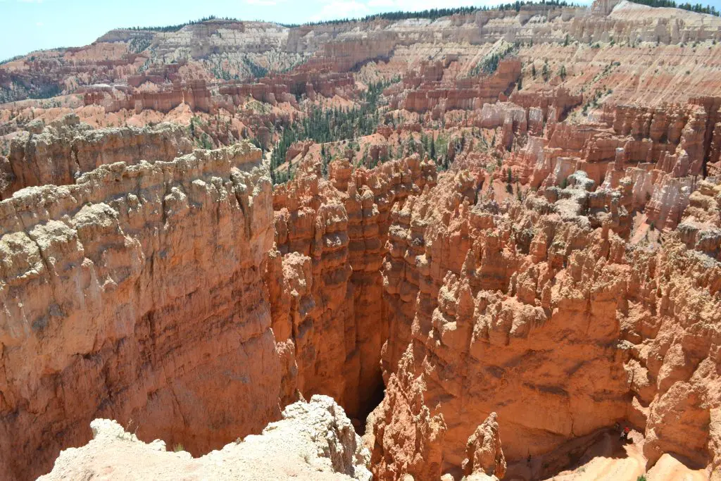
Bryce Amphitheater
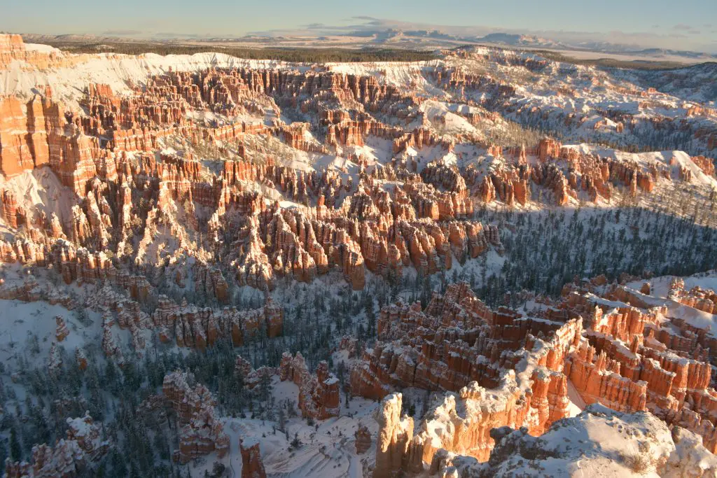
The largest collection of hoodoos, or rock spires, in the world are right here in the Bryce Amphitheater. Inspiration Point. (U.S. National Park Service)
The four main stops in the Bryce Amphitheater — Bryce, Inspiration, Sunset, and Sunrise points — are open year-round. Each point displays the hoodoos in spectacular fashion.
During shuttle season, visitors can choose to walk at least part of the 5.5-mile Rim Trail one way to those viewpoints, then take the shuttle back. The shuttle goes from the park visitor center to Bryce Point, then to Inspiration Point, Sunset Point, Bryce Lodge, and finally Sunrise Point.
If you choose to walk, the trail is paved between Sunrise and Sunset points. The walk from Bryce Point to Sunrise Point along the Rim Trail is about 2.7 miles one way, with the trail continuing to Fairyland Point another 2.5 miles. The shuttle does not go to Fairyland.
If you don’t want to drive into the park, a shuttle station across from Ruby’s Campground drives a loop from the shuttle station to Old Bryce Town, Best Western Grand Hotel, Best Western Ruby’s Inn, Ruby’s Campground, and then the park visitor center before doing the Bryce Amphitheater Loop.
Sunrise Point
On the north end of the park, Sunrise Point is the first stop if you are driving and not taking the shuttle. The park website suggests starting at the end with Bryce Point, although we choose to go from the beginning.
Named for the spectacular sunrise views, as well as sunsets, it’s a short drive, then walk, from Bryce Canyon City, even shorter from the park lodge and campgrounds. Make sure to rise early enough to view the sunrise. It’s worth it.
At 8,100 feet high, Sunrise Point is a beautiful place to look down on the bristlecone pines. This is also where you pick up the 1.8-mile Queen’s Garden Trail. Sunrise Point (U.S. National Park Service)
Sunset Point
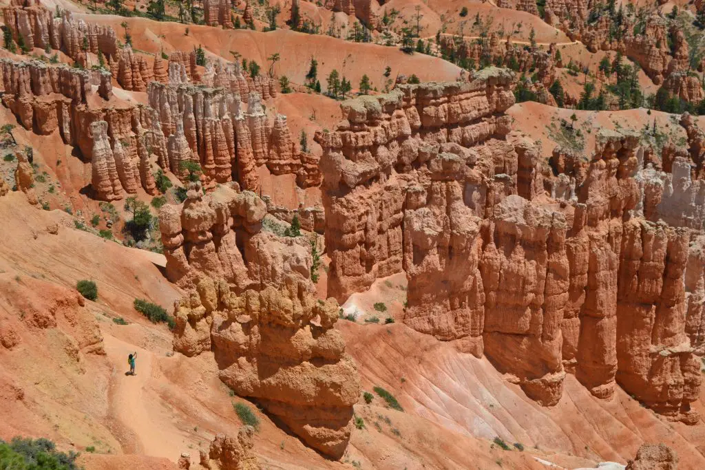
Next is Sunset Point. The popular Navajo Loop Trail starts at Sunset Point, but the Wall Street side of the loop is closed in the winter. You can still walk on the northern side of the loop and catch the Queen’s Garden Trail. Thor’s Hammer and Silent City are below Sunset Point.
The narrow fins and distant hoodoos are stunning at Sunset Point, making it a wonderful place to observe the sun setting.
Inspiration Point
There are three viewpoints at Inspiration Point, which also has an elevation of 8,100 feet.
From Inspiration Point, the Rim Trail heads north to Sunset Point about 0.7 of a mile. It also heads southwest to Bryce Point, 1.5-miles one way, but this section is closed in the winter.
Bryce Point
The park and this viewpoint were named after Ebenezer Bryce, who settled in Paria Valley in 1870 and was known for building a timber road here. Bryce Point (U.S. National Park Service)
Another beautiful location to see the sunrise, there are three strenuous hikes that start at this point. The 5.5-mile Peekaboo Trail, the 4-mile Hat Shop Trail, and the 4.7-mile Bryce Amphitheater Traverse all descend from the Bryce Point rim. Bryce Point (U.S. National Park Service)
Beyond Bryce Amphitheater, which takes up the first three miles of the main drive through the park, there are other places to visit when the snow hasn’t shut down the roads.
Southern Scenic Drive in Bryce Canyon
There are 15 additional miles on the Southern Scenic Drive open seasonally. If you drive to the southernmost end at Yovimpa Point, you can stop at the nine overlooks on the way back which will now be on the right side of the road. Drive the Southern Scenic Drive (U.S. National Park Service)
The elevation near Rainbow and Yovimpa Points is over 9,000 feet, so you may see animals like elk, black bear, and mule deer in this area, according to the website.
Higher Elevation Brings Variety of Animals
With a higher elevation and more forest wilderness than other Utah national parks, Bryce Canyon has a diverse 59 species of mammals. In addition to the mammals above, Utah prairie dogs, pronghorn, and mountain lions are in the park. Mammals – Bryce Canyon National Park (U.S. National Park Service)
About 175 bird species have been seen in the park including the great horned owl, peregrine falcon, red crossbill, woodpeckers, sparrows, bluebirds and more. Birds – Bryce Canyon National Park (U.S. National Park Service)
There are also 11 species of reptiles and four species of amphibians, including the venomous Great Basin rattlesnake. Reptiles and Amphibians – Bryce Canyon National Park (U.S. National Park Service)
Camping in Bryce Canyon
There are two campgrounds at the park, neither has electricity, water, or sewer hookups at the sites.
North Campground, open year-round, across from the visitor center, has 100 sites. The dump station is open only in the summer and potable water is available near the dump station. North Campground – Bryce Canyon National Park (U.S. National Park Service)
Sunset Campground, closed in the winter, is west of Sunset Point and has 99 sites. The dump station, available only in the summer, and potable water are located at North Campground. Sunset Campground – Bryce Canyon National Park (U.S. National Park Service)
Food and Lodging
Bryce Canyon has a full-service lodge, with 114 rooms, suites, and cabins, on park grounds. It looks fantastic online, but we were there before the season opened this year.
According to the website, the lodge is open in 2025 from March 28 to November 10, and the cabins are open May 1 to October 31, weather dependent. Lodging – Bryce Canyon National Park (U.S. National Park Service)
To make reservations for the lodge, go to https://www.visitbrycecanyon.com.
Bryce Canyon City
If you aren’t camping or staying in the park lodge, stay in Bryce Canyon City. I recommend the historic Ruby’s Inn.
Make sure to eat one of your meals at the Cowboy’s Buffet and Steak Room, inside the hotel. Literally the best buffet I’ve ever had, and I don’t usually eat buffets. A meat lovers paradise, it had barbecue ribs, orange chicken, meatloaf, pot roast, and roasted chicken, to name a few. In addition, there was seafood, a salad bar, dessert bar, and tons of side dishes.
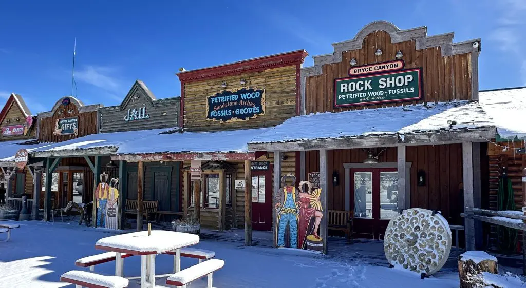
Across from the Ruby’s Inn is the touristy Old Bryce Town strip with a rock shop, souvenir shops, old western photography, ice cream and candy. Fun place for the family. Although closed in the winter, I’ve been to the strip before and enjoyed looking at the rocks and fossils at the Rock Shop.
Bryce Canyon City is a family-friendly town. In season, activities include a rodeo, live country music dinner shows, and wagon rides. Tours include ATVs, helicopters, and horseback riding. Bike rentals are available. Winter activities include ice skating, cross-country skiing, and snowshoeing.
Drive through Red Canyon
Just west of the national park is Red Canyon on Scenic Byway 12. The rock formations are incredible and one of the best places to take photographs.
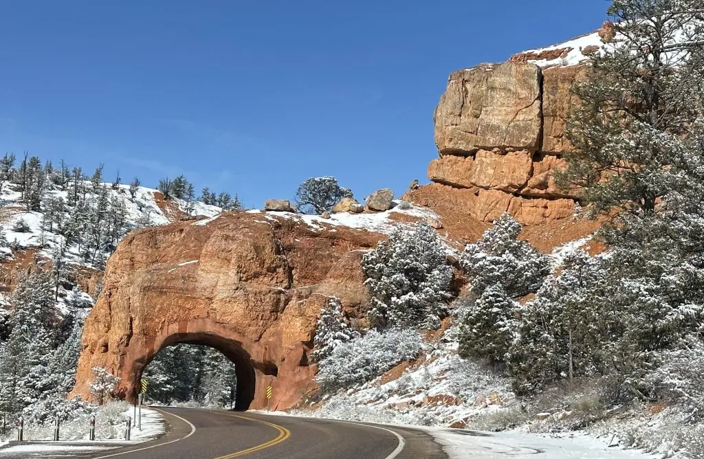
If you are heading to Zion National Park, you’ll head through two natural tunnels carved into the red rocks.
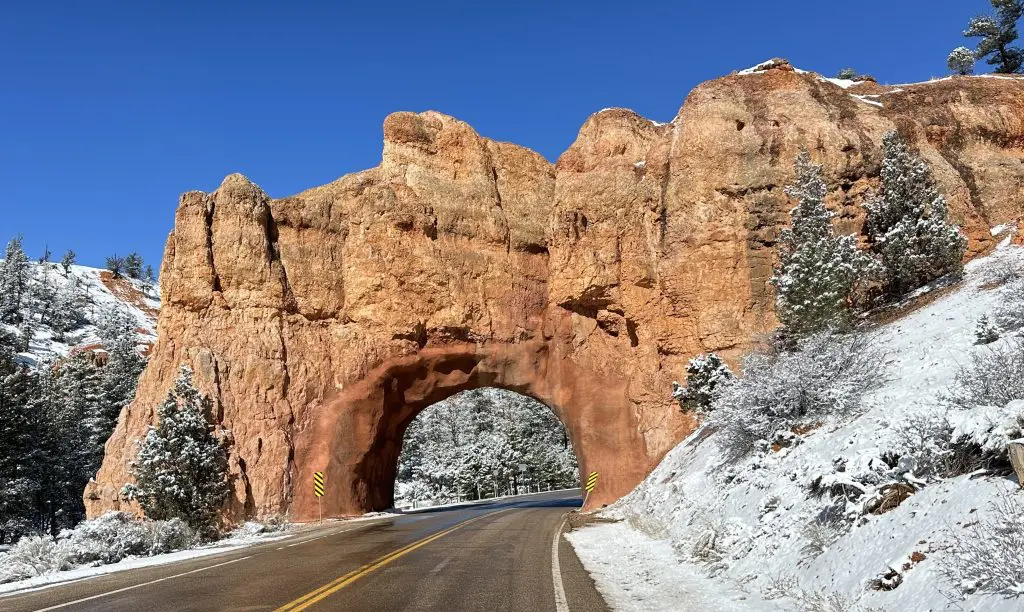
And what a difference the sun makes. The day before was cloudy due to a snowstorm. The day we left was sunny and not a cloud in the sky, so the red rock really popped.
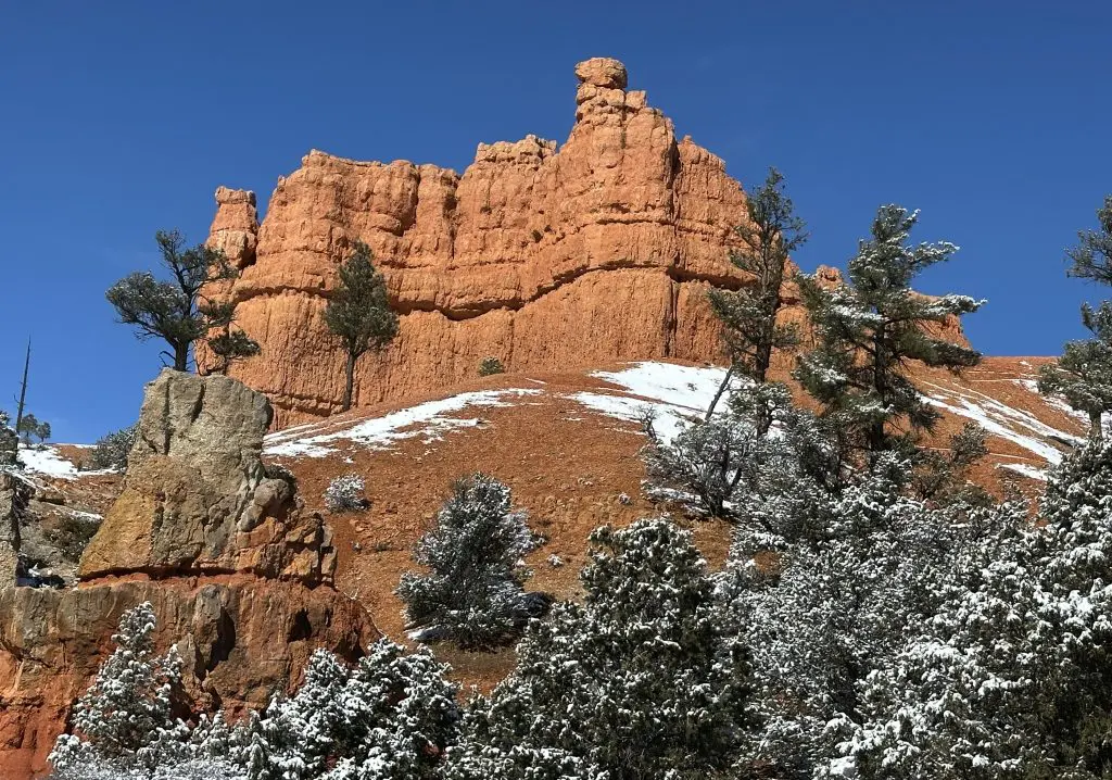
The evergreens among the red rock canyon with a dabble of snow truly are stunning.
For more tips and information on Utah national parks, check out Capitol Reef: See Rock Formations and Highlights In A Day – Travel Like A Tourist